Lidar Observatory at Otlica
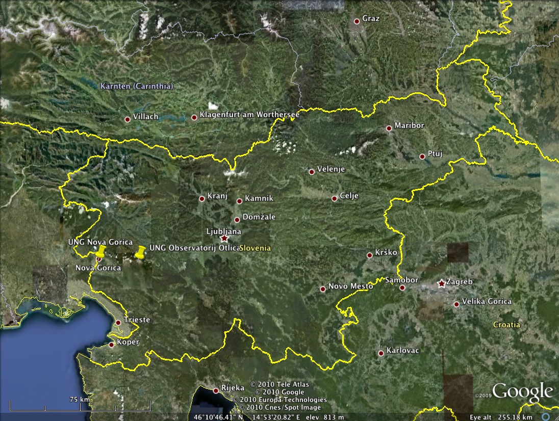
Figure 1: Location of the Otlica observatory.

Figure 2: Lidar Systems at Otlica. Telescopes and the laser are mounted on a steerable frame allowing for vertical scanning.
Lidar systems
An elastic (Mie scattering) lidar developed by the Laboratory for Astroparticle Physics has been installed at the observatory since 2005, and a Raman scattering lidar developed by the Centre for Atmospheric Research has been installed in 2009. All lidar systems are oriented toward southwest with a fixed azimuth angle, but the elevation angle is steerable in the range from -5° to 90° allowing for 2D spatial scanning. Maximum range of the system is about 40 km, so the scans cover the Vipava valley, the Carst plateau and land-sea interface over the coastline of the Bay of Trieste, which is 30 km away.
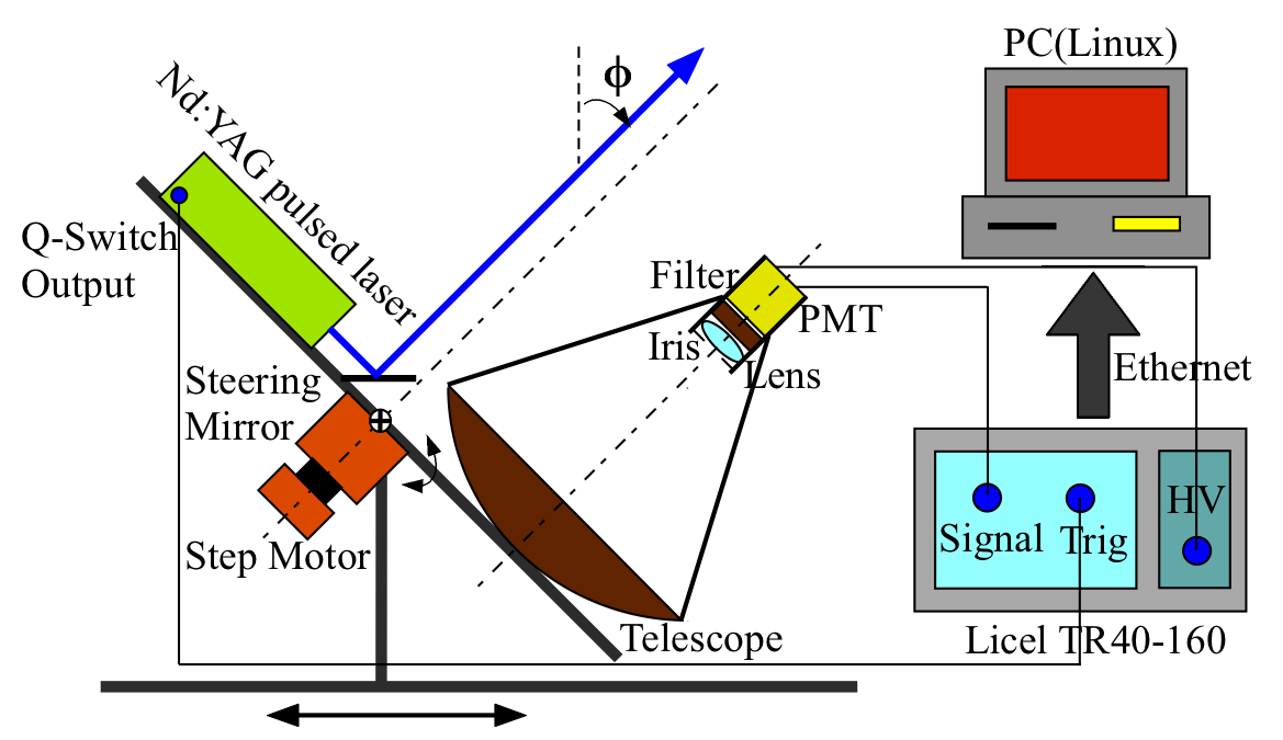
Figure 3: Schematics of the Mie lidar system at Otlica observatory.
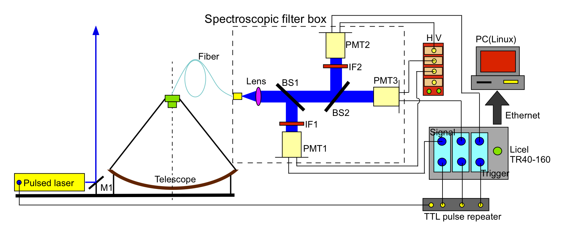
Figure 4: Schematics of the Raman lidar system at Otlica observatory.
Transmitter
Nd:YAG laser (Quantel Brilliant B) with triple basic frequency, emits 5 ns long UV pulses in the atmosphere with the wavelength of 355 nm and energy of 120mJ/pulse. Laser beam is alligned with the field of view of the receiver using a two axis computer confrolled motor system.Receiver
Parabolic mirror with focal length of 41 cm, a diameter of 80 cm, and effective area of 1.5 m2, collects the light and focus it onto the detector optics. This is in the case of the Mie lidar a single channel system for collimation of the 355 nm backscattered light and a 5 nm bandwith interference filter to reduce the background and in the case of the Raman lidar an optical fiber leading to a spectroscopic filter box, which splits the light into 3 different detection channels (355 nm, 407.4 nm and 386.5 nm) and corresponding 5 nm interference fiters. After the filters, backscattered beams are directed to the photomultiplier tube (PMT), which converts the received light into measurable electrical signals. Amplitudes of the electrical signals are proportional to the power of received light. The transmiter and the receiver are mounted on a metal construction that enables one-dimensional scanning of the sky within the lidar's filed of view.Data Acquisition
Digitalization of lidar measurements is performed by an analog/digital (AD) converter (Licel transient recorder) and read out by a Linux/C++ based computer for data acquisition and analysis. From the time delay between the laser broadcasted light pulse and the received signal the distance to scatterer (the aerosol layer) is calculated, and from the intensity of backscattered light the density of aerosol layer is obtained.Measurements
Lidar system at Otlica is used for study of the atmospheric boundary layer and its properties, in particular in remote sensing of aerosols and estimation of their impact on some optical properties of the atmosphere. The more aerosols that are present in the atmosphere, the stronger is the scattering of the laser emitted light. As aerosols scatter light in all directions, the back-scattered part can be detected by the lidar's receiver, digitized by a transient recorder and logged by a computer.
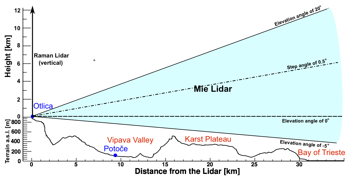
Figure 6: Schematic 2D view of the lidar scanning plane with geographic features.
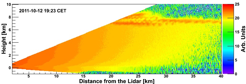
Figure 7: 2D scan of the atmosphere between Otlica and the Adriatic. A range of clouds at a height of about 7 km can be seen.
Photo Gallery